Exploring Mount St. Helens
To celebrate the start of summer and the easing of COVID-related restrictions on outdoor activities, some friends and I headed out to Mount St. Helens for a long weekend. Our goal was to run/hike the 50km Loowit Trail around St. Helens on Sunday and summit the next day. This was definitely and ambitious schedule, but we felt confident with the long summer hours that we could get both done.
Planning
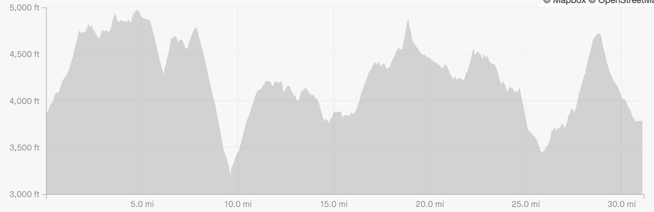
The Loowit Trail circumvents Mt St Helens. It is about 50k (31 miles) with 7000ft of elevation gain throughout. The trail is not particularly well marked or runnable due to the boulder fields and loose scree climbs. A further complication was the lack of water sources on the trail, many reports mention only two or three streams on the entire route. To be honest, all the trip reports made the trail sound very challenging and I was intimidated.
The summit was less intimidating to plan. There are two popular ways to summit St Helens: Monitor Ridge (summer) and Worm Flows (winter). We were just in time for the trail head (Climber’s Bivouac) for the Monitor Ridge route to be cleared of snow and re-graded. The summit can be reached in summer with very little climbing equipment, microspikes and poles seemed to be plenty.
We reserved two sites at the Lone Fir Resort. The resort has real bathrooms, warm showers, and a restaurant. This was the epitome of car camping, but we could use all the comfort we could get. It was nice having the chance to eat a burger and have a shower before heading to bed.
Day 1: Loowit Trail
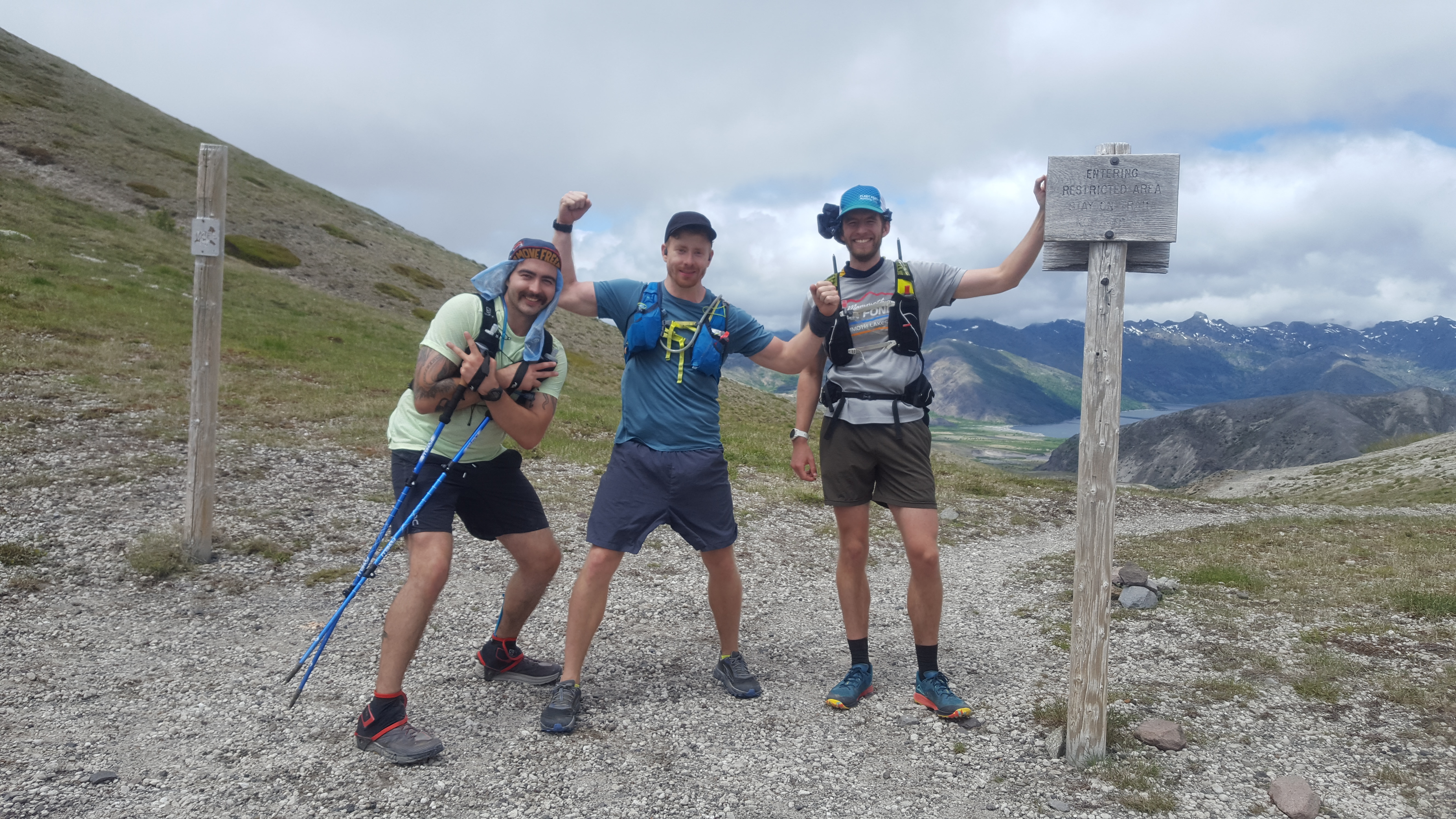
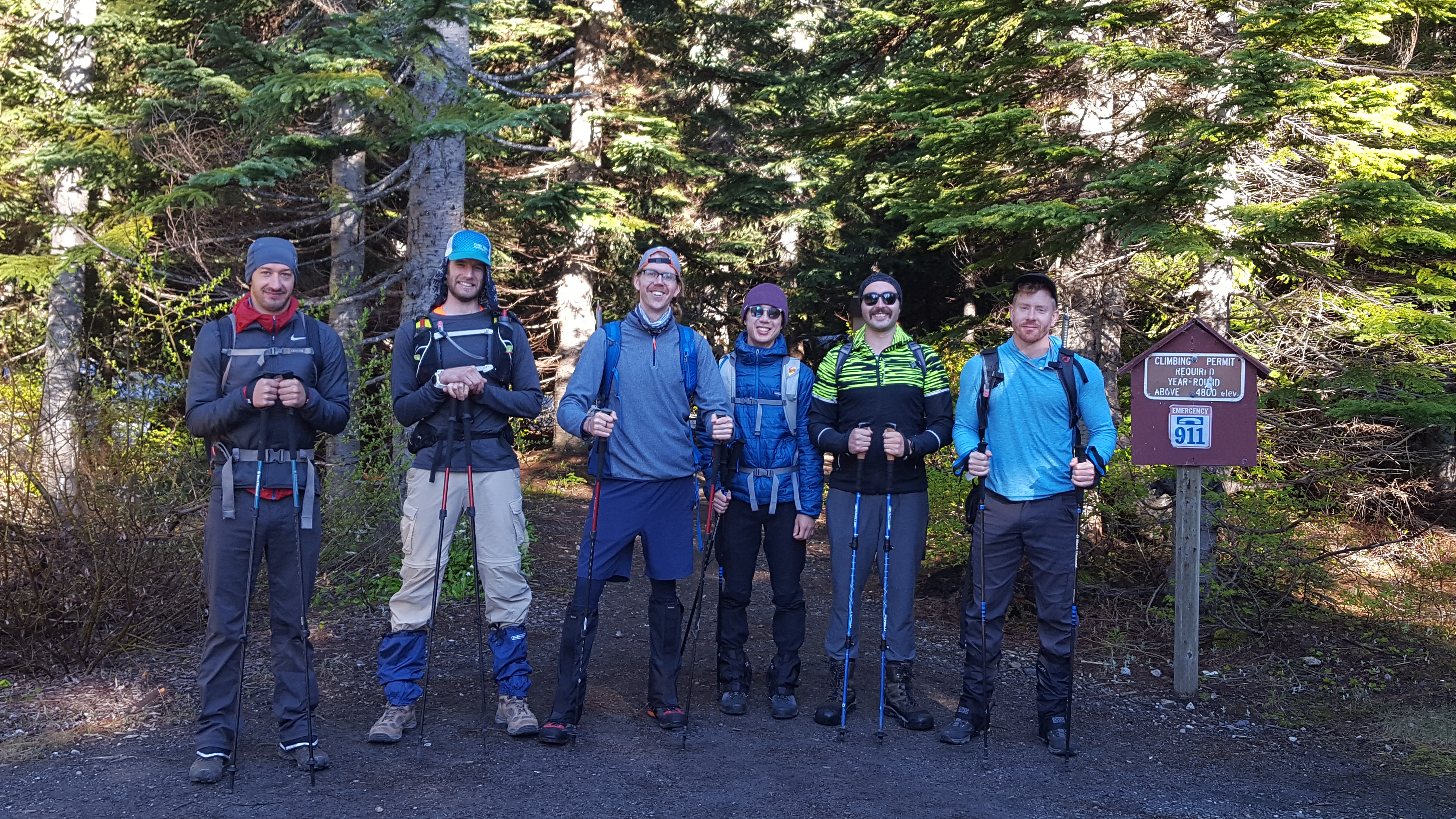
We had a crew of five going on the Loowit Trail. Even after preparing our gear the night before, it still took us an hour after our 6AM wakeup to be ready to leave camp. We drove out of camp around 7:00 and started up the trail at 7:30.
The first 1.5 miles from Climber’s Bivouac to the Loowit are uphill but very runnable with just a few patches of snow. Once on the actual Loowit, we got into some boulder fields pretty quick. I’m sure some folks are able to prance right over those boulder fields but we picked our way through pretty slowly and carefully.
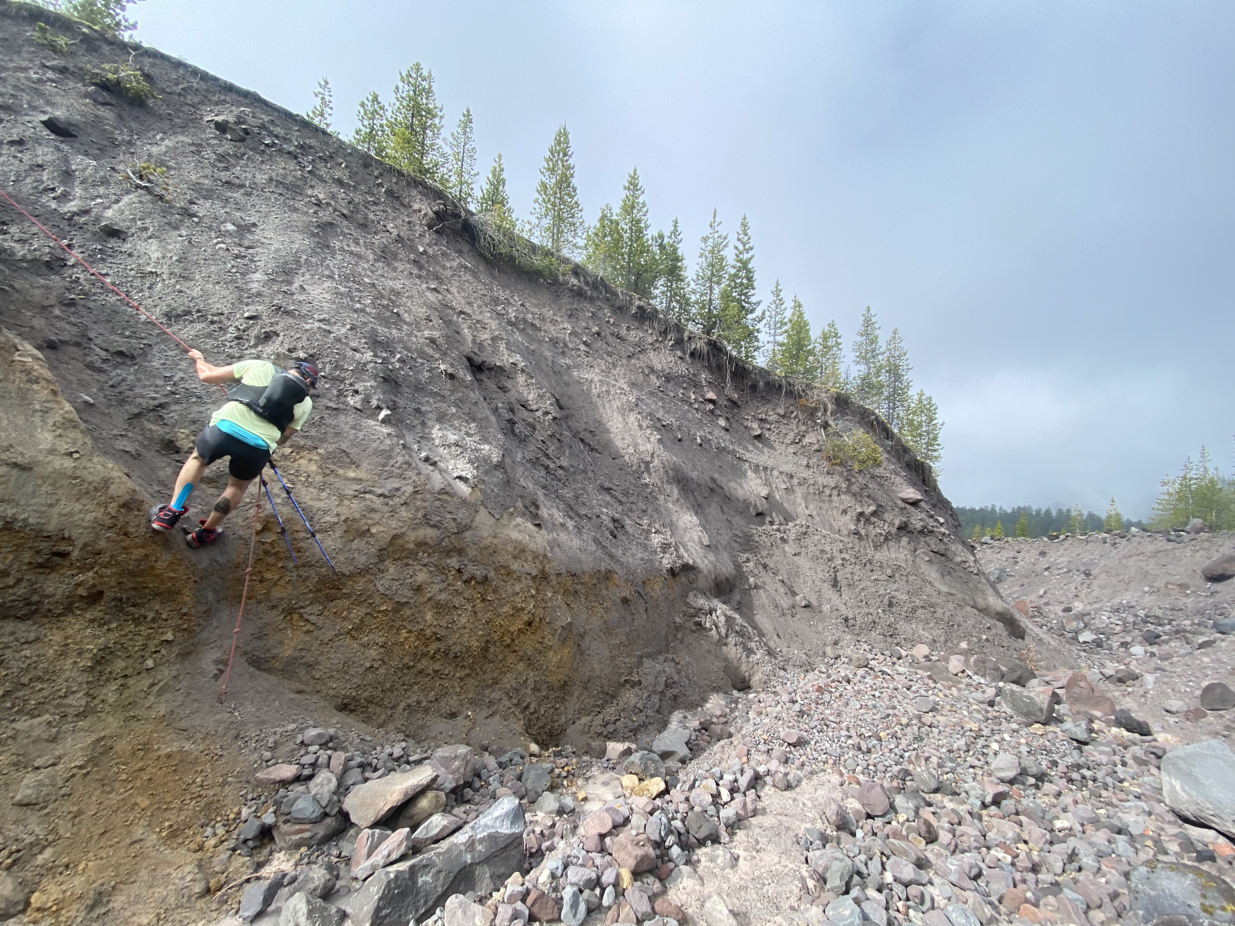
About 6 miles in we crossed our first major gully. This was the first time we got to use the fixed ropes so often mentioned in trip reports. It was a nice change of pace from normal trail running – those last couple yards to the bottom are steep!
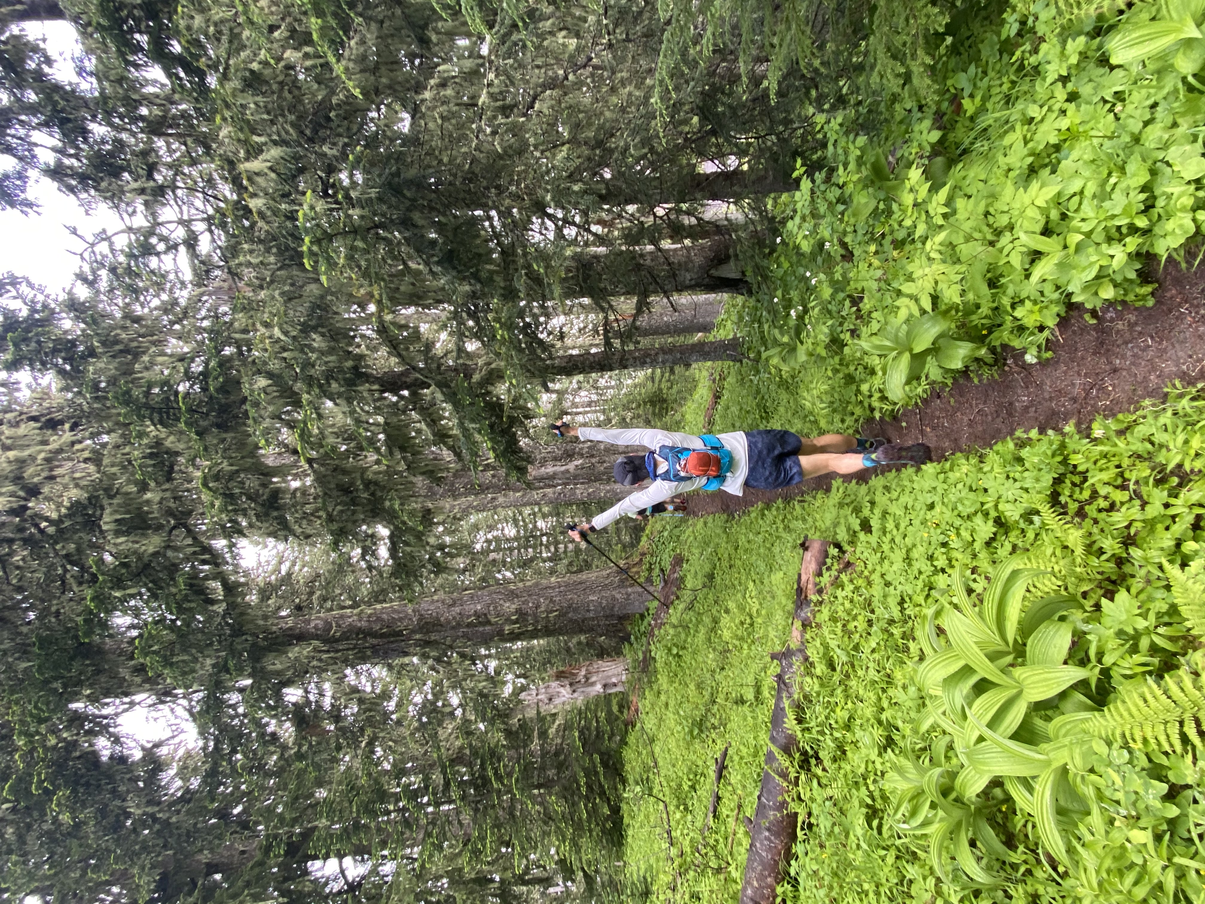
After a short climb out of that first gully, we enjoyed a wonderfully runnable and surprisingly lush section of trail. Roughly 9.5 miles in, we reached the South Fork Toutle River crossing. This is one of the few water sources on the trail so we all filled up. A few backpackers mentioned having seen bears up ahead but we never caught a glimpse of ‘em.
The climb out of the South Fork Toutle River crossing was challenging. It was only about 1000ft but very loose rock – sand almost. It was a relief to get to the grassy plains on top but we were getting gassed at this point.
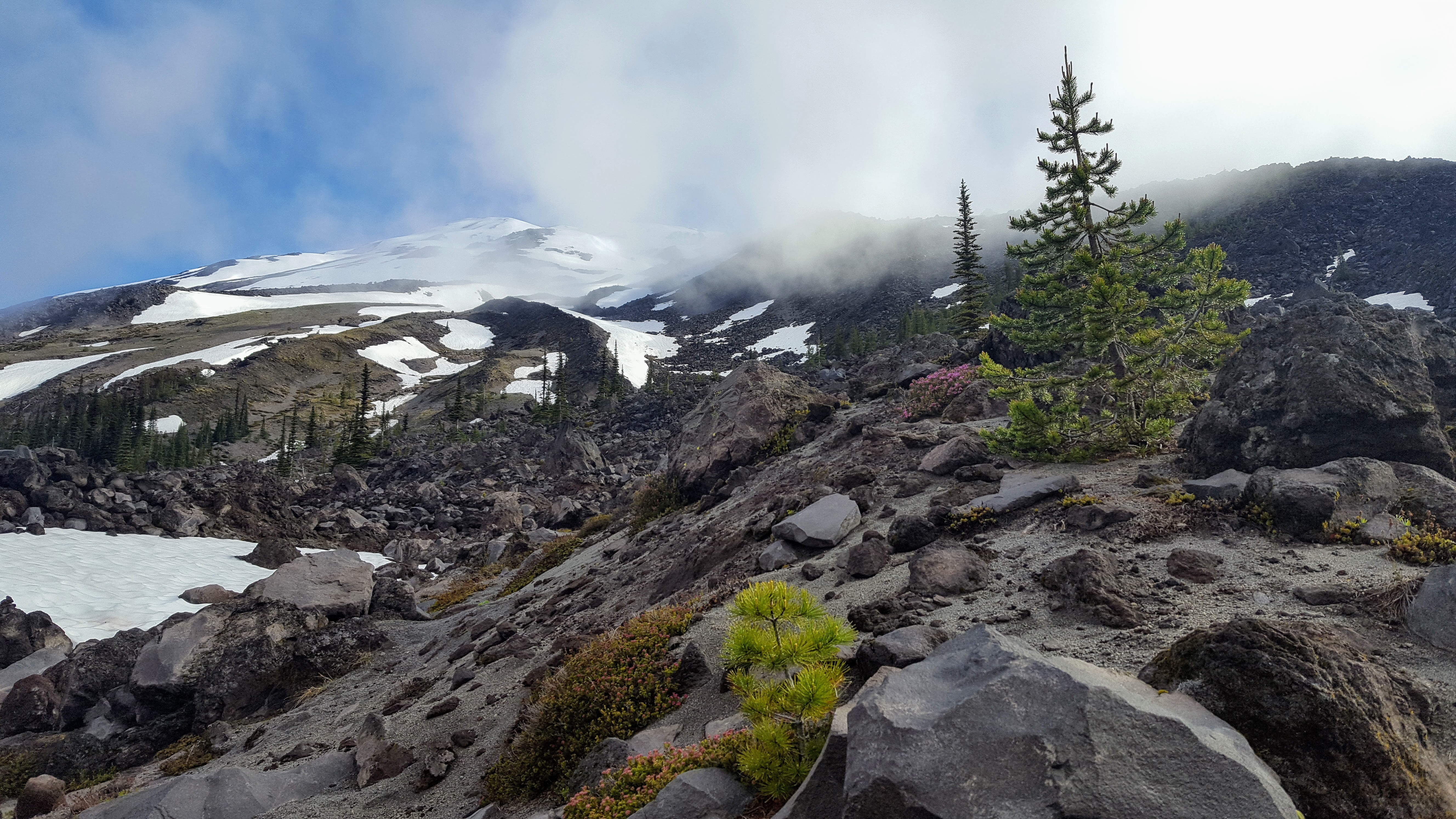
The grassy fields slowly turned more barren as we headed towards the northernmost side of the loop. This is the start of the “blast zone” from the 1980 eruption. We had lunch in this zone around mile 15. I felt fortunate that it was still overcast, there was very little coverage from the sun in the whole north side of the loop.
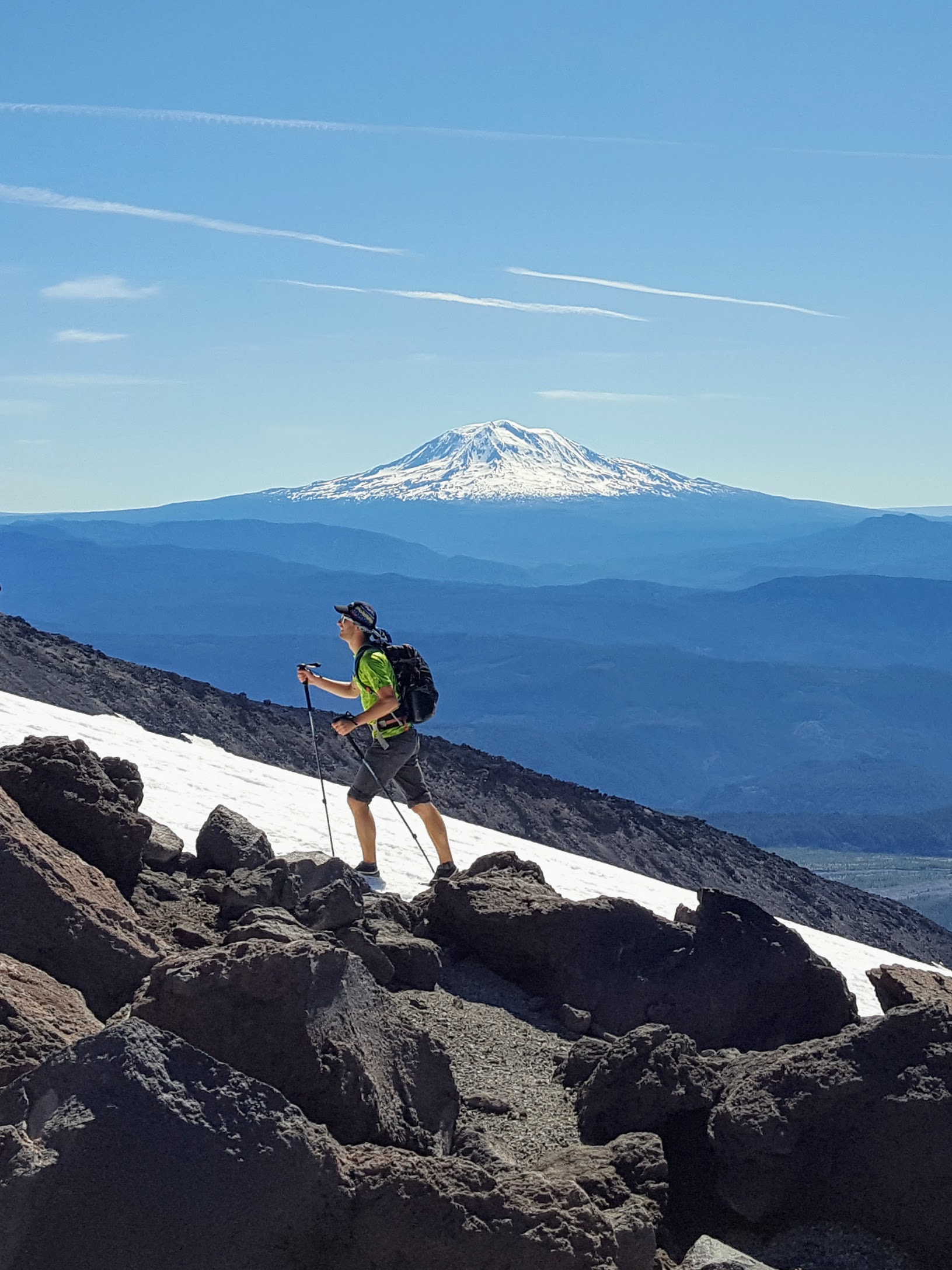
Soon after a lunch of dank sandwiches and a totally-worth-the-weight orange, we headed toward the next notable climb. The climb to windy pass starts off with looser rock then graduates to older, stronger stone. We spotted a few mountain goats on the adjoining slopes here.
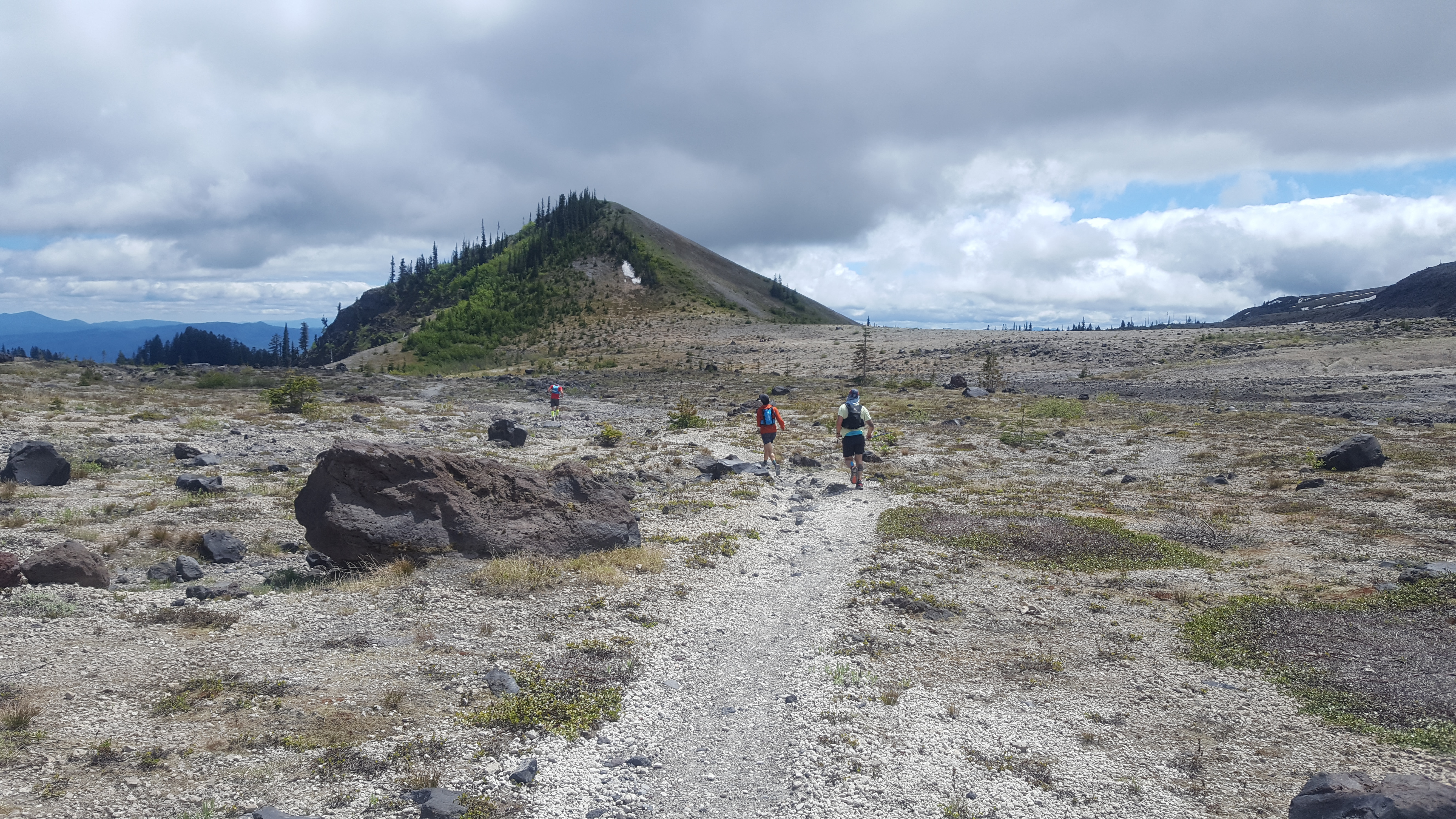
After a loose and messy descent down from windy pass, we arrived a possibly the most dramatic section of the trail. This area is known as the Plains of Abraham and it didn’t disappoint. The ground is nearly totally level with a single trail going off into the distance. We were all having a great time on this section, we were totally blown away by the scenery. I took one of my favorite pictures from the trip here, a small hill where the entire south side is still blasted clear from the eruption.
At the Eastern end of the planes, we found a lovely water source. At this point we had been underway for about 7 hours and run 20 miles. The next six miles were pretty reasonable and took us all the way to the June Lake Trail intersection. At this point, we were well back on the south side of the loop and were definitely smelling the barn. We figured it was about 3 miles further along the Loowit to reach the intersection for Climber’s Bivouac, where we had started our loop.
We left the June Lake Trail fork (26 miles into the run) at about 4:15PM. Little did we know that the next 3 miles would take us up a 1500ft climb. Not to mention, we were suddenly back to hiking in sizable snow sections as well as enormous boulder fields. It took us just about an hour and a half to travel the three miles from the June Lake fork to the Climber’s Bivouac.
We were so happy to reach the fork where we had started our journey on the Loowit trail. The last 2.5 miles back to the trailhead were blessedly runnable. The feeling of running on a wide gently downhill trail after struggling through boulders and snow is incredibly liberating. We finished up the trail in just about ten hours and 45mins total. Overall, the group was excited to get the loop in the bag and we were ready to rest up for the summit the following day.
Day 2: Summit
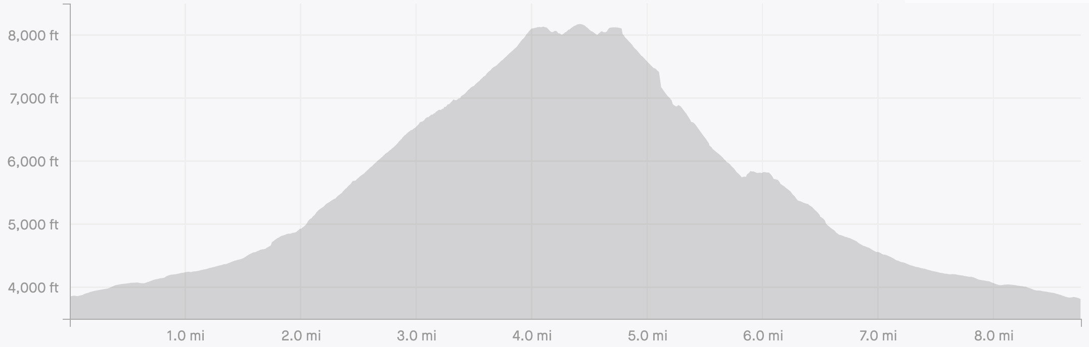
The morning for summit day was about the same as the previous morning: 6AM wakeup, start up the trail at 7:30AM. We were joined by one more friend today, making us a crew of 6. The summit route is about 9 miles with 4500ft of gain.
We took the same trail out of the Climber’s Bivouac as we had the day before. However, instead of turning on to the Loowit trail, we crossed it and headed up the mountain. About a mile past the Loowit intersection, the the trail started getting snow covered and we popped on microspikes.
After the snow started, it was about a mile and a half slog up Monitor Ridge to the crater rim. Once we were on the main part of the ridge, we had the choice between hiking on the exposed rock or the snow fields to either side. We generally found sticking to the rocks to be the fastest.
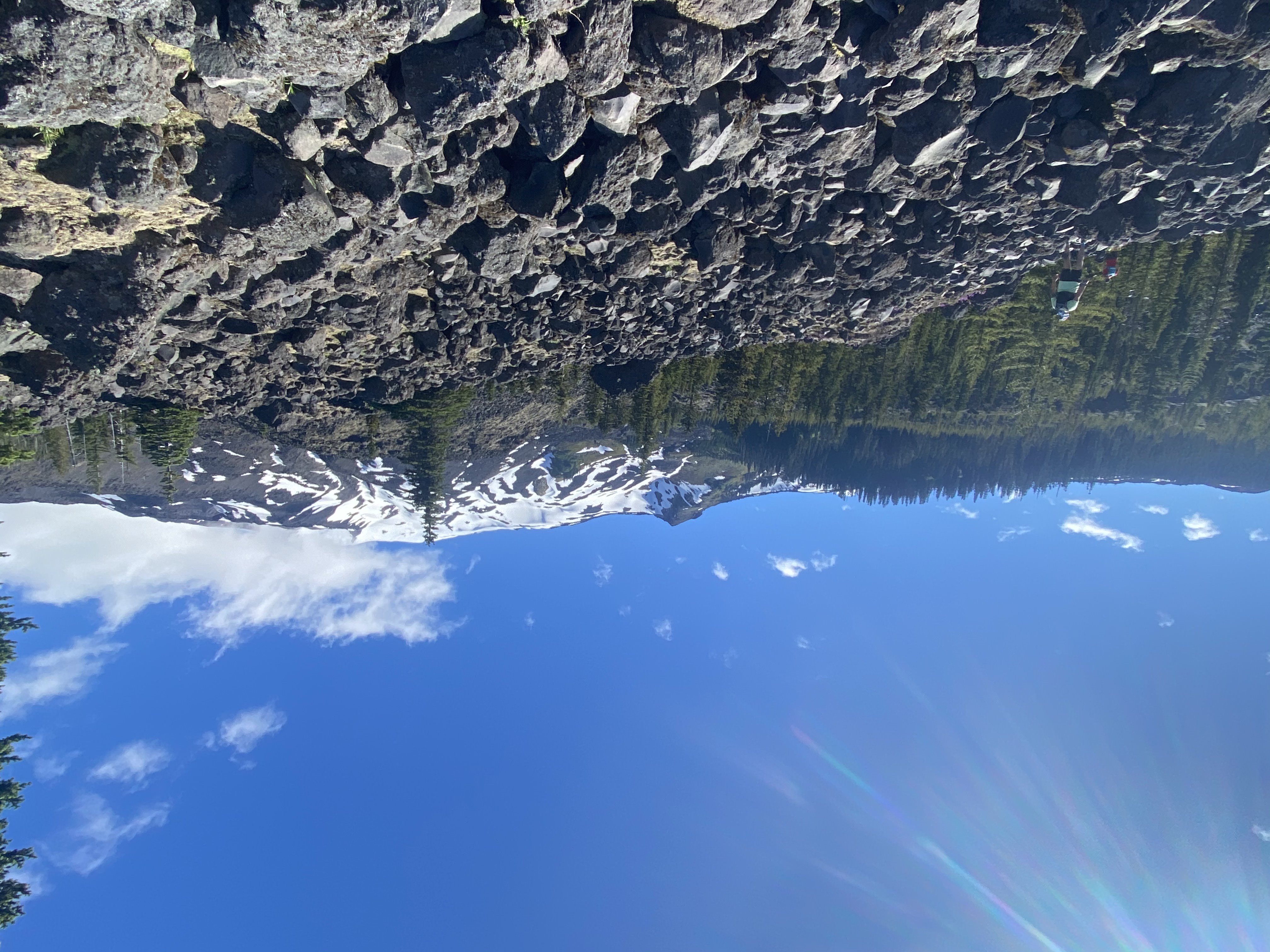
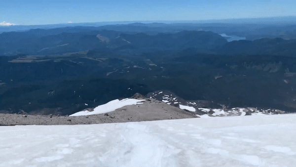
It was a perfect bluebird day and we had a fantastic view of Mt Adams the whole way up. Even Mt Hood could be made out way off in the distance! We made it to the top of the rim just before 11AM. The top of the rim had some great views. There was a cornice of snow reaching over the top of the rim but it was marked off with sticks. The photo below has the true summit in the background.
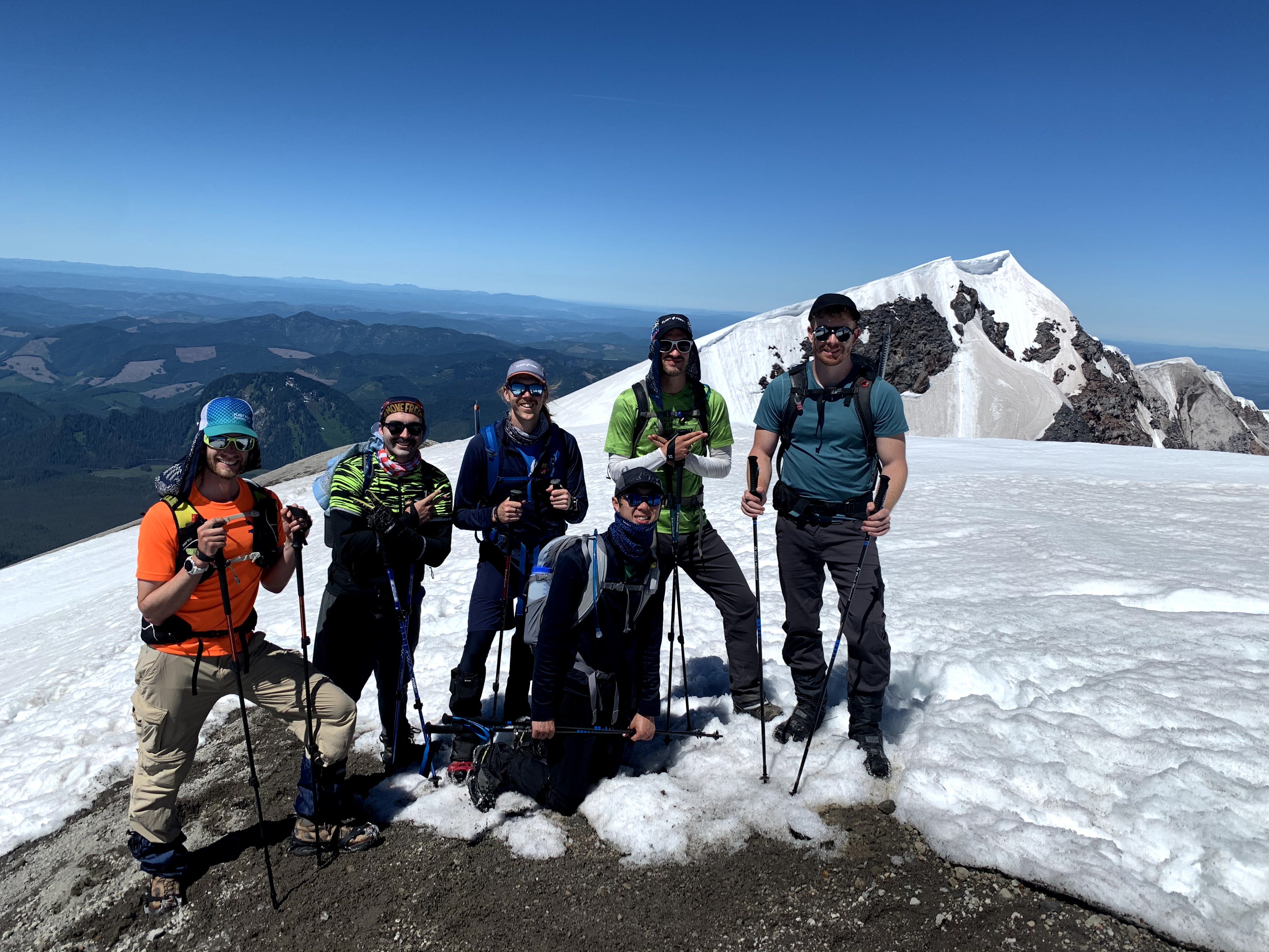
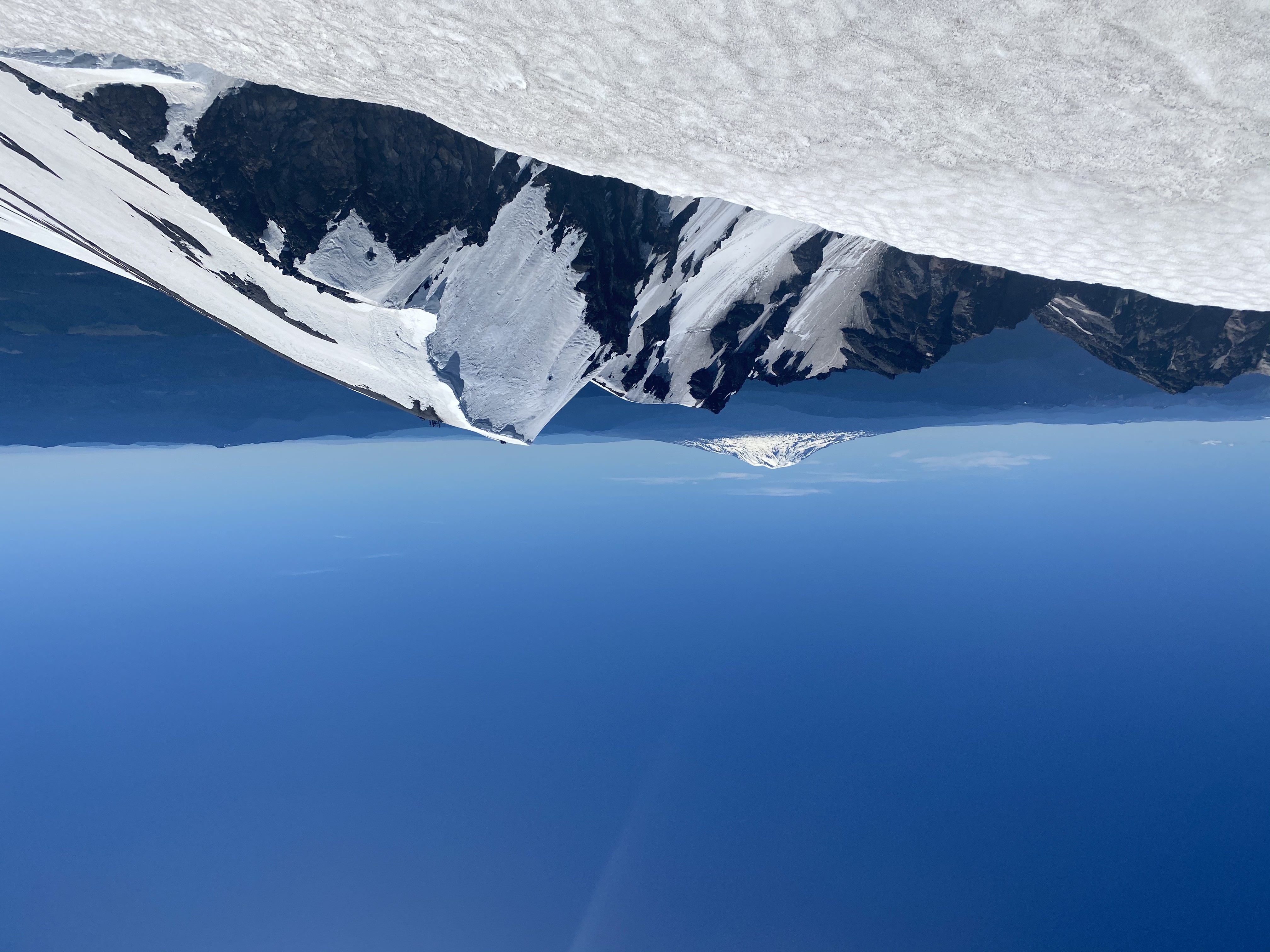
After our photo op, we made our way along the ridge to the true summit. The section from the top of the ridge to the true summit had a bit of down-climbing and a snow field. We felt secure in the boot track and staying away from the edge of the rim in case of the cornice. Picture below is from the summit looking back towards where we arrived at the top of the rim with Mt Adams in the background.
We made it to the true summit at around 11:45. We enjoyed sandwiches and chocolate there before starting the descent. Descending was a ton a fun, we did a lot of glissading and snow running. There was one tricky climb over extremely loose rock we had to made in order to get back onto a ridge we had glissaded below. Otherwise, the descent was pretty straightforward.
The End
We were proud to get everyone around the Loowit and onto the summit without much drama. There were a few first-time 50ks and alpine summits in our group which was fantastic. One of the biggest lessons learned for me was not to put too much stock in single trip reports. A few people had reported extremely challenging conditions and impossible to follow trail on the Loowit, which just wasn’t the case. I’d highly recommend both of these adventures and fitting them into a single weekend makes for a great logistic and physical challenge.