Mammoth Grand Fondo and Mt Whitney
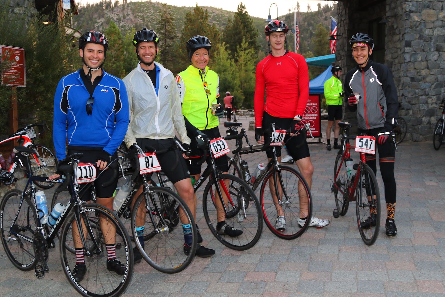
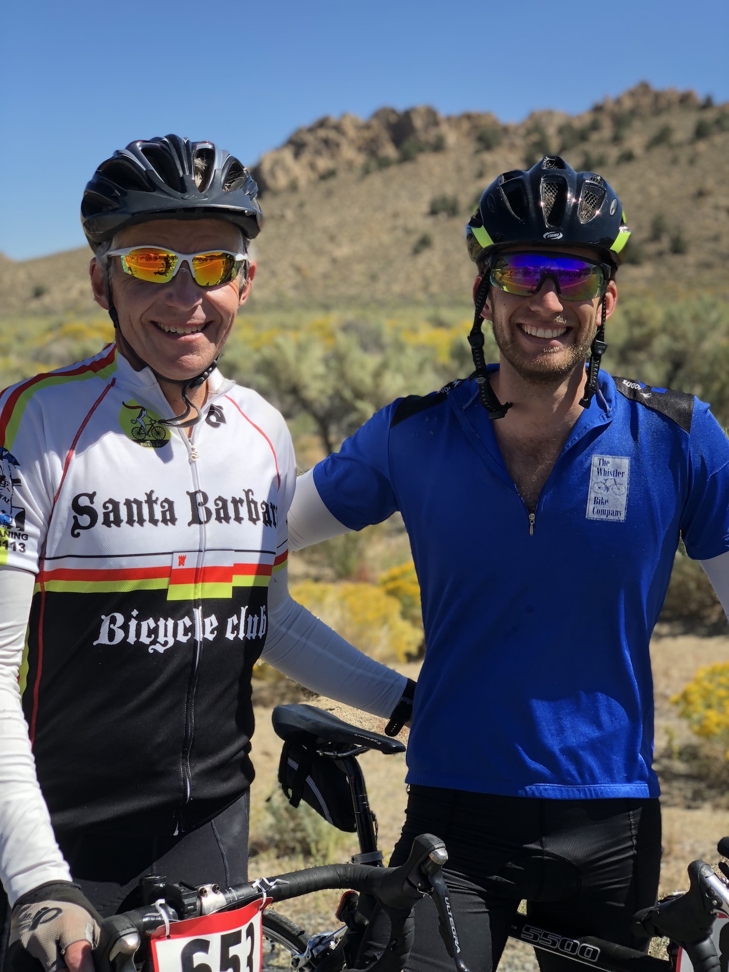
I wanted to have one big adventure before the summer was over. After talking to a few friends, we decided on the Mammoth Lakes Gran Fondo. We got together a group which included my dad (Rob) and 4 of my old teammates from the UCSB crew team (Evan, Andrew, Justin). I would fly into SFO and hitch a ride from there with Evan.
Once the ride was chosen, I looked around for what else to do in the area since Mammoth Lakes was quite a trip to make for 1 day of riding. I decided to try and tack on a Mt. Whitney summit after the ride to make the travel worthwhile. I was fortunate enough to get Whitney permits for Monday after the ride.
As a last bonus, I would stop by my parent’s house in Santa Barbara to visit my mom before heading back to Seattle :).
Planning
Once the events were set in stone, the real planning began. As it turns out, none of the half-dozen bike shops in Mammoth rent road bikes. This meant that I’d either have to rent a bike in a nearby city or fly with my own bike. I decided to fly with my own bike since I’d be flying into SFO and out of SBA and wouldn’t be traveling through the same towns more than once.
I found a hard-shell bike box on craigslist for $130. After some messing around with my bike and my cat, I got it to fit nicely. The box is 32” W x 48” H x 11” D which is pretty gigantic and about 55lbs if I put my bike shoes and tools in it.
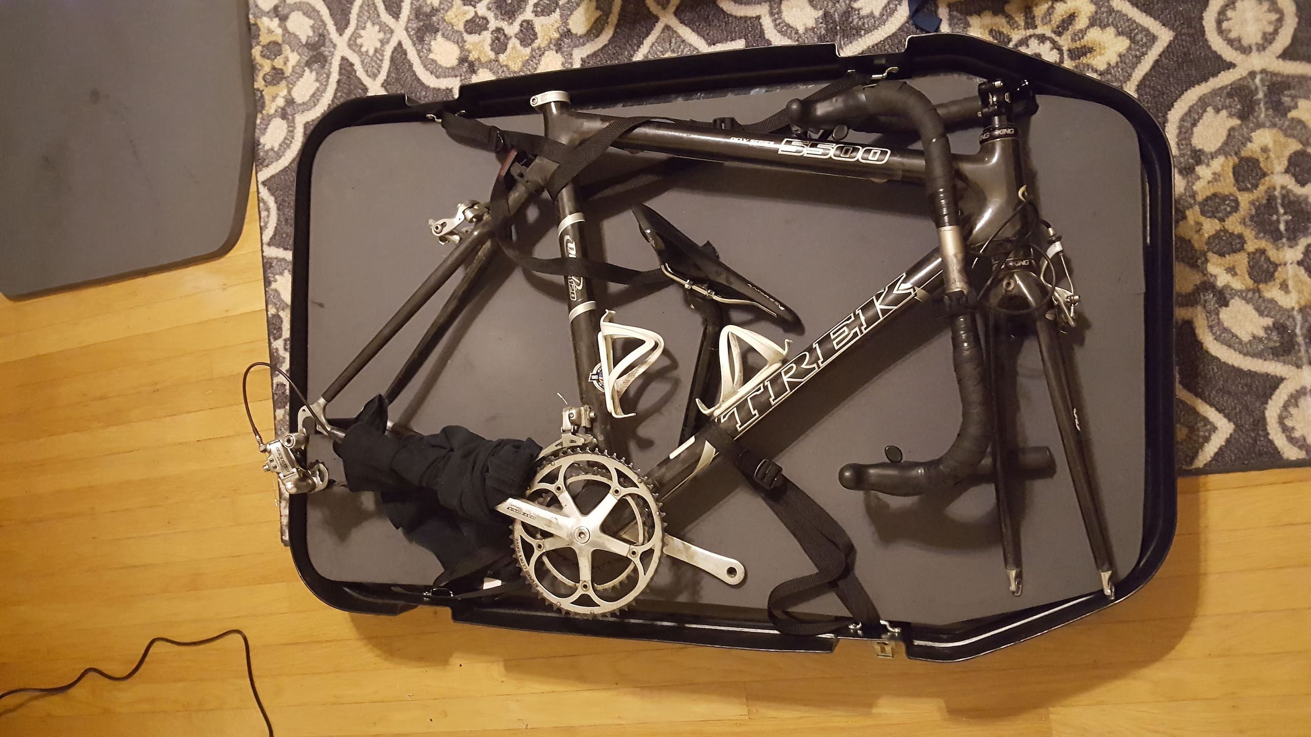
Fortunately, Alaska Airlines treats oversized baggage as regular checked baggage if it is sports equipment. If I wore my hiking boots on the plane, I managed to get by with a carry on, personal item, and checked bike box for the whole weekend. Score!
Lodging was much easier to sort out. I booked an Airbnb a few minutes ride from the race start in Mammoth lakes for Fri-Sun and my dad got a hotel in Lone Pine for Sun-Mon.
The Ride
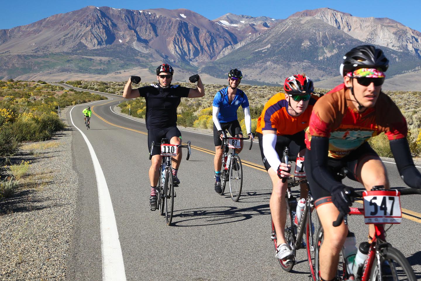
We had a 5:15 wakeup and 6:15 departure from the bnb to get to the village by 6:30 for a 7AM start. There were about 1100 riders doing the 102 mile version of the ride. We got a police escort for the first few miles out of the town and down to highway 395.
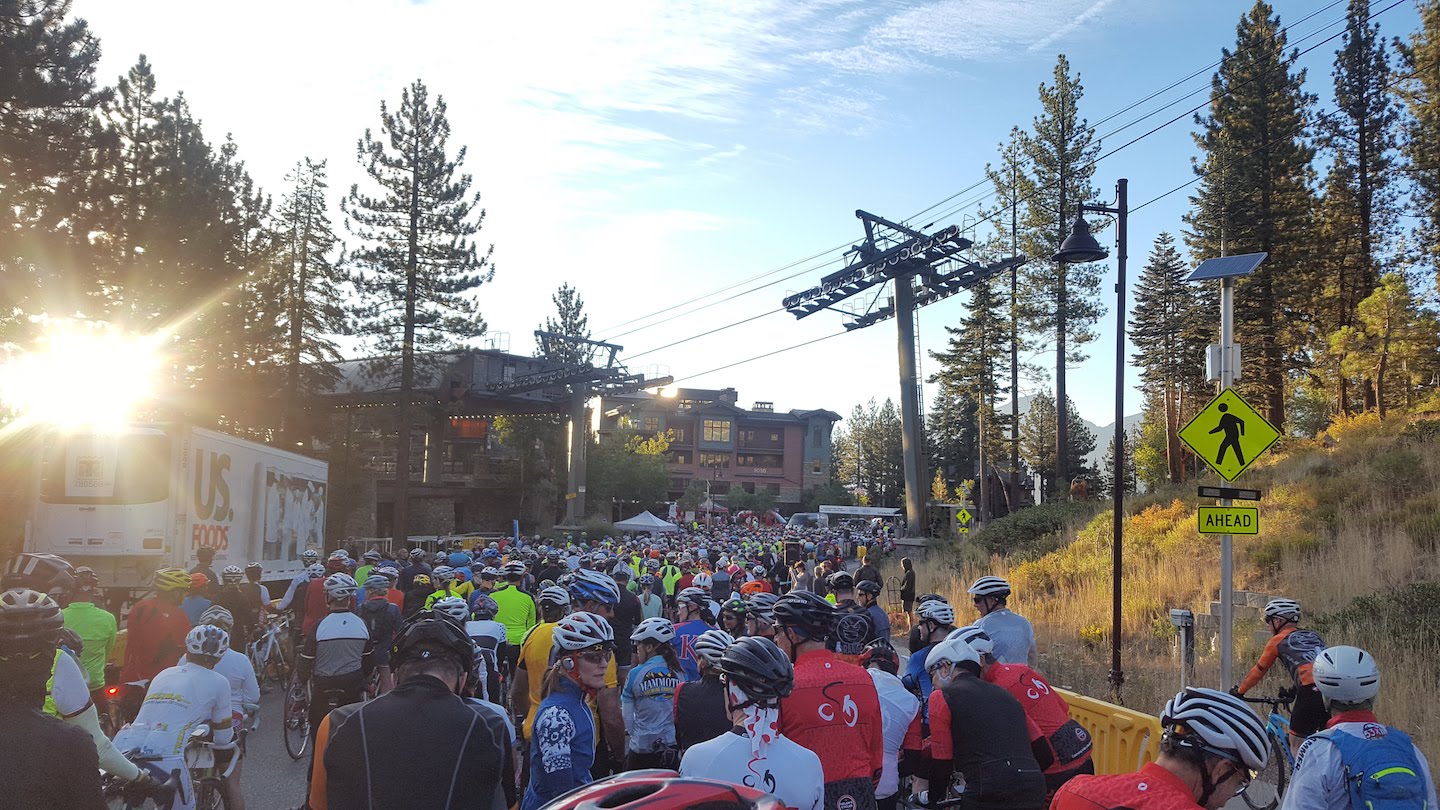
The ride boasted a single stoplight and 75 miles of road closed to through traffic. It also promised to be challenging with 6600ft of elevation gain over 102 miles, all of which happened between 6500ft and 8000ft altitude.
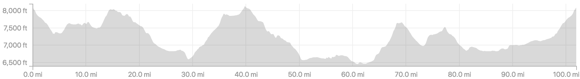
The ride overall was very smooth. The hills were reasonably graded, good asphalt, and wide shoulders. The only techincal problem our group had was one double flat which delayed us about 30 minutes. Considering we were riding over 500 miles combined, that is a pretty good day! We enjoyed all 6 aid stations the ride offered to their full extent. The big climb around mile 60 was tough, but we were all smiling and ready for more at the top.
The most challenging part of the race was the last 20 miles or so. A stiff head wind picked up, making even the downhills less of a recovery. The last 10 miles to the finish were a long steady climb right into that headwind. I suffered in the back with Andrew while Rob, Justin, and Evan finished it a bit ahead of us.
We enjoyed the free meal that came with our entry fee, a pile of pizza, and the bnb jacuzzi/pool after we were done.
The Hike
Sunday was spent packing up our stuff, cleaning the bnb, and making the 2 hour drive from Mammoth Lakes to Lone Pine. Lone Pine is the town closest to Whitney Portal, the trailhead for Mt. Whitney. Only my dad and Evan decided to stay for the hike.
We knew it would be a hot day on the mountain, in the high 80s or 90s in the afternoon. For that reason, we wanted to get going up the trail by 2AM. Giving ourselves 30 mins in the hotel and another 45mins to drive to the trailhead, park, and suit up meant a 12:45 wakeup call. Ouch.
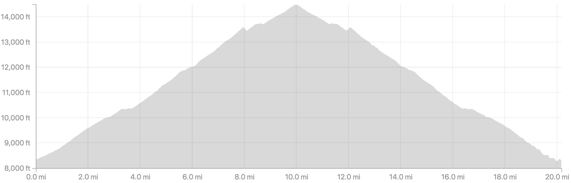
Day-hiking Whitney is not very easy. It is about 22 miles with 6600ft of gain, starting at about 8300ft altitude. Altitude sickness is pretty common, especially for those spending the night before in Lone Pine at 4000ft rather than at the trailhead. The hike can be broken into a few parts.
- Start at whitney portal trailhead at 8300ft
- 6 miles to the basecamp at 11800ft
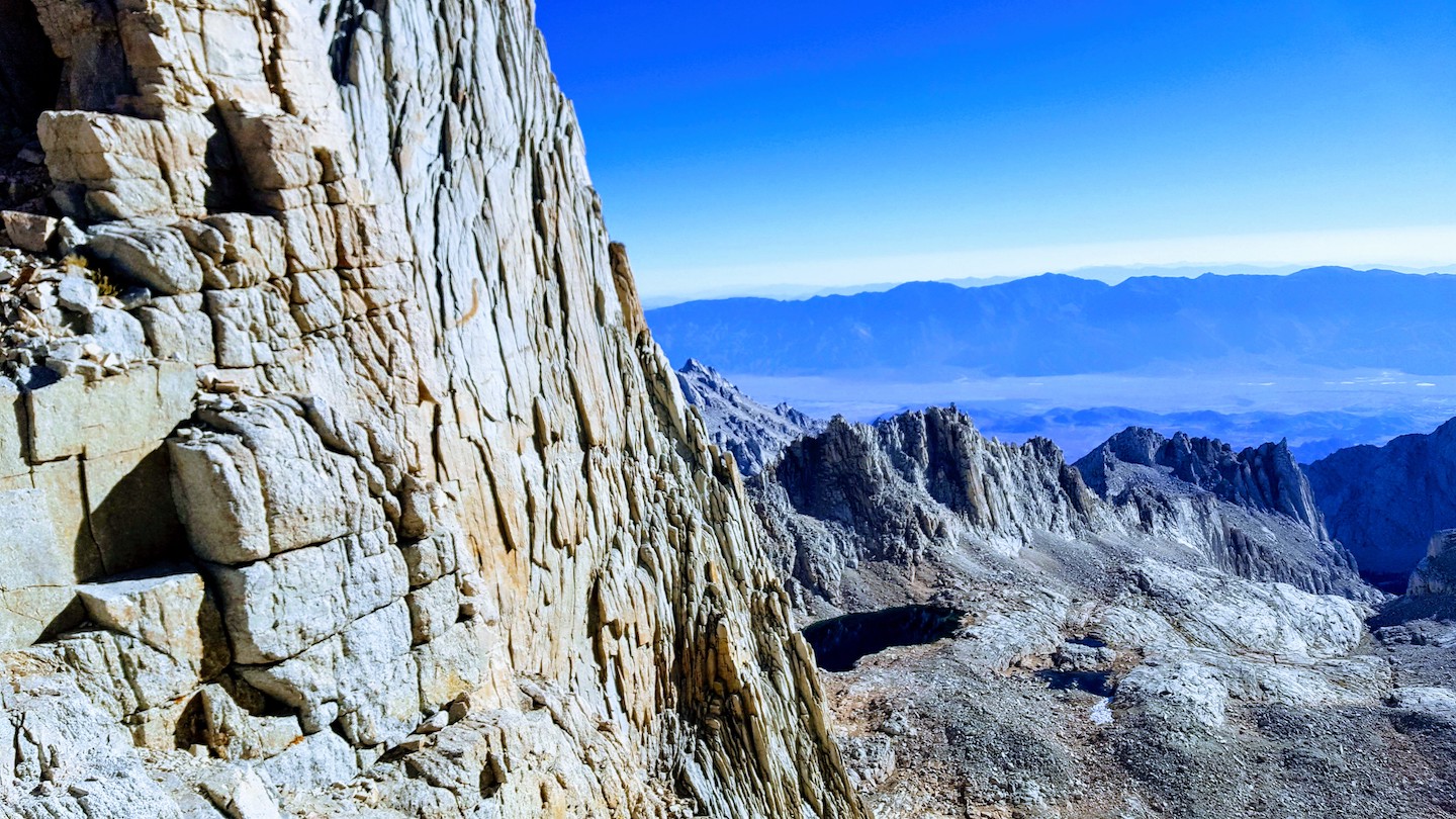
- 2 miles up switchbacks to the crest at 13400ft
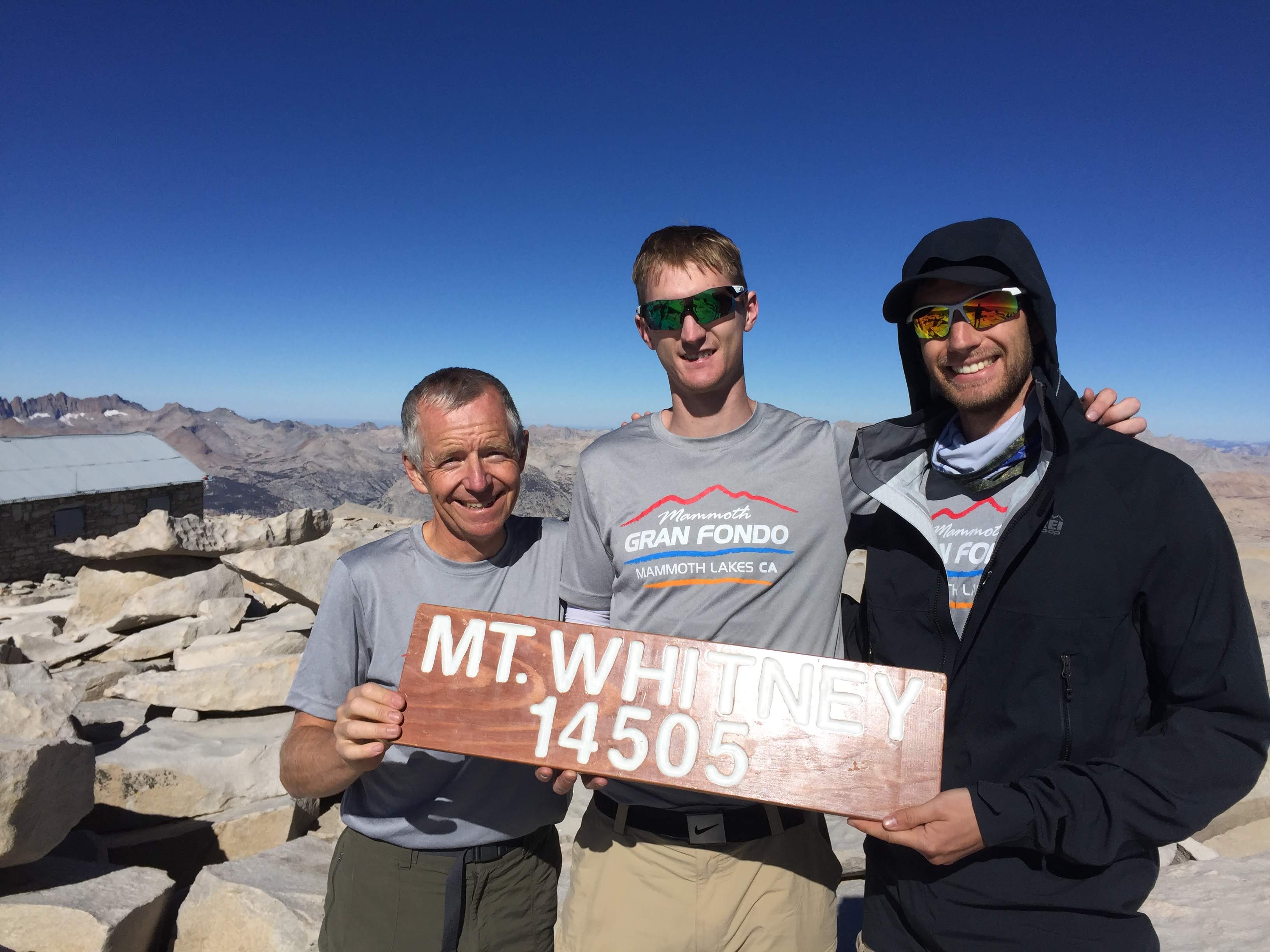
- 2 miles along the ridge to the summit at 14505ft
- back down the same way
I woke up feeling nauseous and with a headache. Not sure of the cause besides exhaustion and dehydration, but I was bumming pretty hard. I wasn’t able to eat anything before setting out on the trail but decided to go for it anyway.
We hit the trail by 2:15 and I slowly got through a banana and a cliff bar in the first few miles. I was feeling sick as a dog until sunrise around 6AM. The rest of the group also wasn’t feeling fantastic of course, but they were nice and held back a bit.
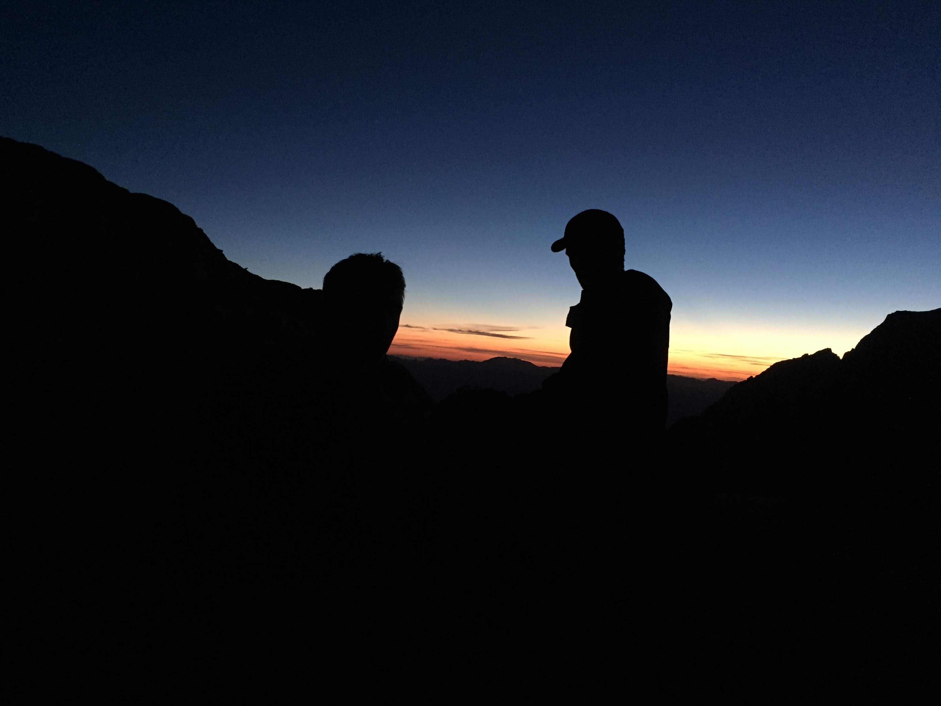
The sun rose when we got the basecamp and I felt 50x better. I downed a clif bar and most of a large bag of trailmix while we made the trek up the switchbacks. The views down from the switchbacks into the valley with the sunrise were stunning.
We made great time up the switchbacks (about 1hr 20min) and took about the same time to get from the crest to the summit. I popped a few advil to fight off the altitude headache. We hung around the sumit and ate for about 15 minutes before heading back down.
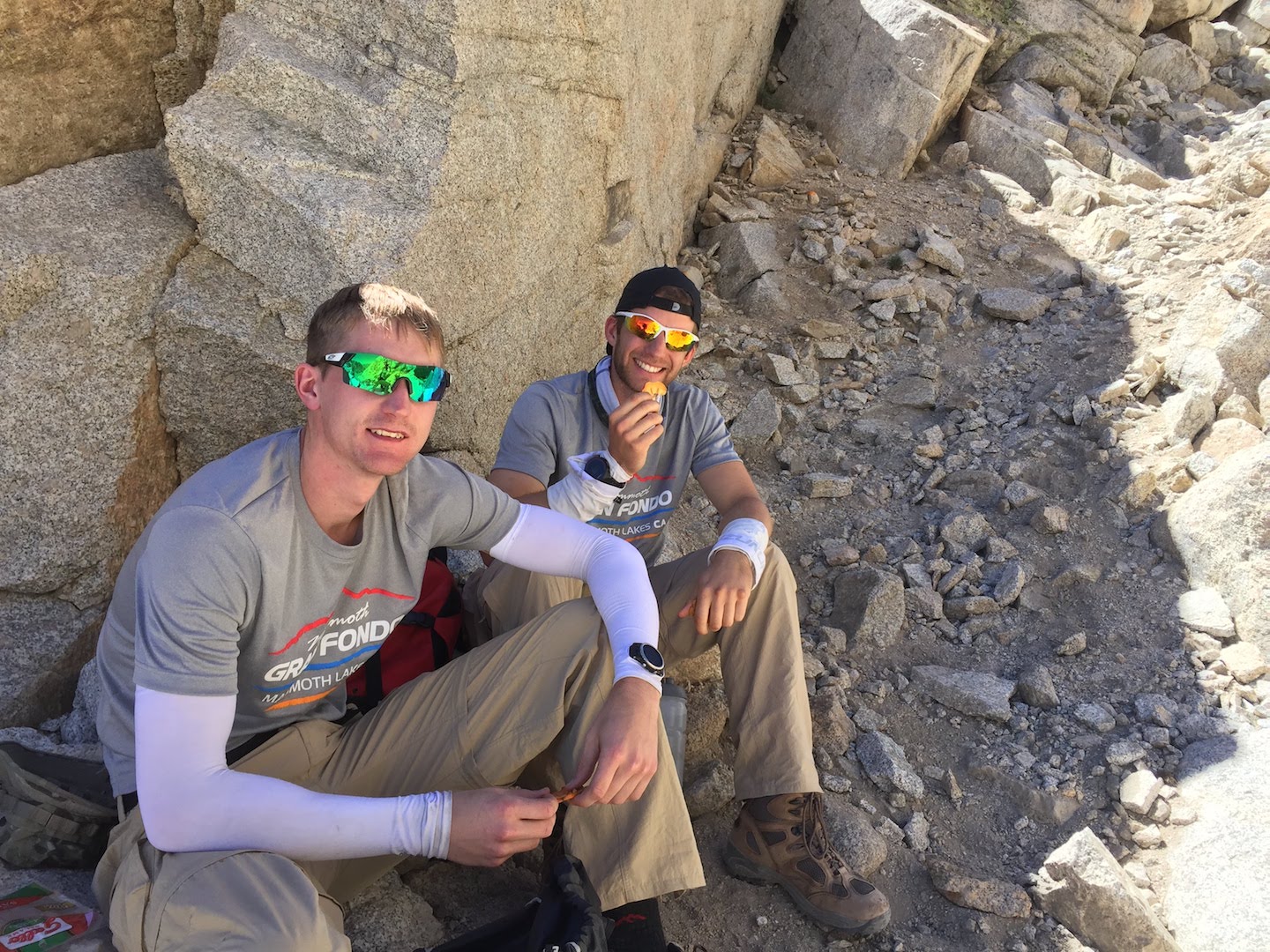
As always, the way down turned into a bit of a death march and it did get quite hot towards the end. I was feeling much better by this time though and enjoyed salami bagels and all our other snacks on the way down. All told, we were out from 2:15AM until about 2:45PM.
After it all, my Dad and I made the 4hr drive back to Santa Barbara. I enjoyed a great dinner with parents, a fantastic sleep and a lovely beach walk and brunch with Mom before my flight back to Seattle on Tuesday afternoon.